
The best boating apps for recreational use are Navionics (charts and depth), Argo Navigation (community reports and free tier), TZ iBoat (hardware integration), Windfinder (wind and weather), Fishbrain (fishing spots), and the U.S. Coast Guard app (safety and regulations). Round those out with NOAA Radar Pro and MarineTraffic for free situational awareness, and you have a complete toolkit for nearly any outing.
Quick picks at a glance:
- Navionics Boating — editor's pick for chart depth, SonarChart bathymetry, and offline maps
- Argo Navigation — best free-tier chart app with crowdsourced hazard reports; NOAA and Army Corps chart coverage for U.S. and Canada
- TZ iBoat (TimeZero) — best for hardware-connected setups; NMEA/AIS integration and raster/vector charts make it the closest thing to a pro plotter on a tablet
- Windfinder / Fish Weather — best quick weather check for wind, swell, and go/no-go decisions
- Fishbrain — best community fishing app for crowd-sourced spots and catch logs
- NOAA Radar Pro / NOAA Buoy Data / NOAA Buoys Live Marine — best free official weather and sea-state data
- MarineTraffic — best free AIS viewer for busy harbors and commercial traffic awareness
- U.S. Coast Guard app — best safety reference for regulations, float plans, and emergency contacts
- Aqua Map Boating — best for NMEA integration on inland and coastal U.S. waters
- Squid — best dedicated routing app for sailors and offshore passage planning
- Marinus Lite — best lightweight option for short outings with minimal battery drain
- RaftUp — best social app for finding raft-ups, events, and nearby boating groups
Trust signals: Navionics uses community-sourced SonarChart depth data alongside official charts. Argo pulls live NOAA data. Expert reviewers at Yachting World consistently recommend pairing a chart app with a dedicated weather app. Goldenwatersports staff use these pairings with renters on Lake Coeur d'Alene every season.
Key Takeaways
The single most effective setup for recreational boaters is one dedicated chart app paired with one weather app, both with offline data downloaded before departure.
| Point | Details |
|---|---|
| Editor's chart pick | Navionics Boating leads for depth data, offline charts, and SonarChart community bathymetry. |
| Best free utility | Install the U.S. Coast Guard app and NOAA Radar Pro at zero cost before any other app. |
| Best weather pairing | Windfinder or Fish Weather alongside your chart app gives a cross-check no single app's built-in overlay matches. |
| Offline charts first | Download charts for your specific lake or coastal area before leaving home; cell coverage drops without warning. |
| Goldenwatersports | Goldenwatersports renters on Lake Coeur d'Alene get the best results pairing Argo Navigation with Windfinder, both free at the basic level. |
Table of Contents
- How do the best boating apps compare across key features?
- Mini-reviews: what each top boating app actually does
- How to choose the right boating app for your trips
- Which app fits your specific boating activity?
- Expert tips, safety reminders, and a rental checklist for Lake Coeur d'Alene
- Our perspective on testing these apps on local lakes
- Ready to try these apps on Lake Coeur d'Alene?
- Sources
How do the best boating apps compare across key features?
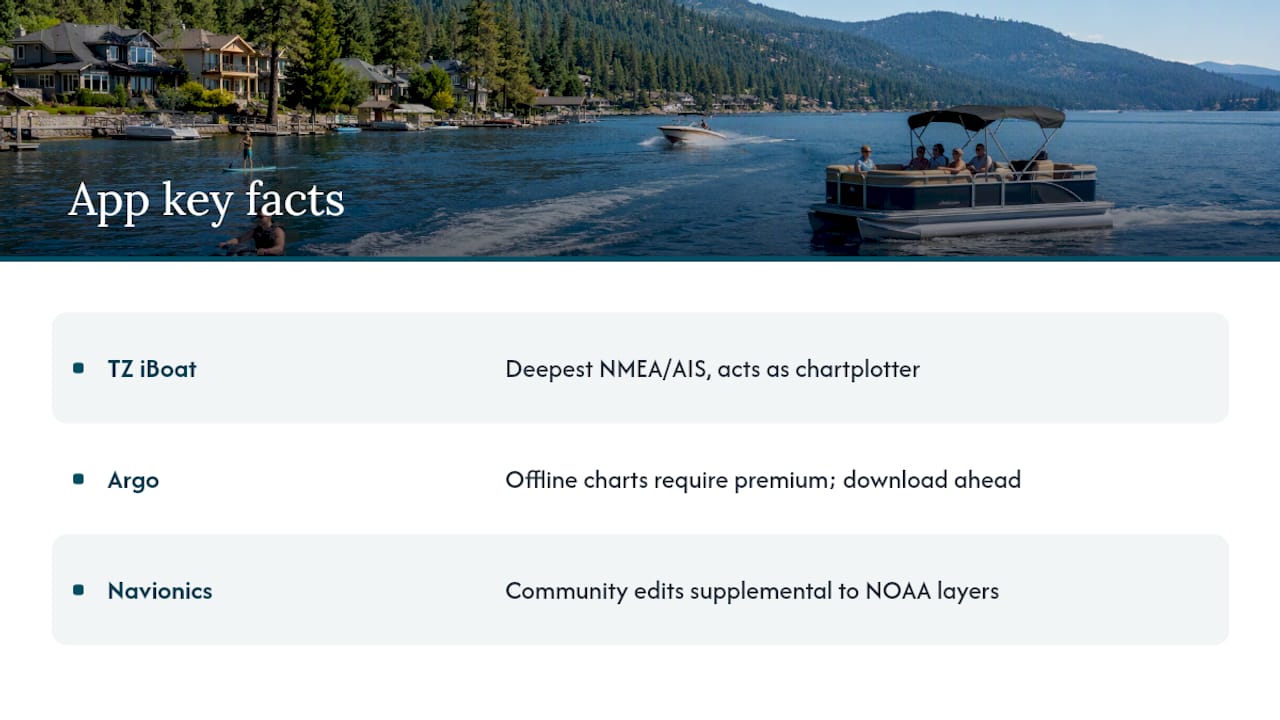
A few things the table doesn't fully capture: TZ iBoat's NMEA/AIS integration is the deepest of any app here, turning an iPad into a genuine secondary chartplotter when connected to a boat's onboard network. Argo's offline charts require a premium subscription, so download before you leave the dock. Navionics community edits are useful but treat them as supplemental to official NOAA layers, not a replacement.
Mini-reviews: what each top boating app actually does
Navionics Boating
The go-to chart app for most recreational boaters. SonarChart HD bathymetry gives anglers and cruisers depth contours that official charts often miss on smaller lakes.
- Offline charts available after download
- Auto-routing with depth and obstacle avoidance
- Community edits and SonarChart crowdsourced depth updates
- Tides, currents, and basic weather overlays
- Syncs with some Garmin hardware
Free tier: limited chart area. Paid: ~$29.99/year for full chart access. Best for anglers and coastal cruisers who want the richest depth data available on a phone.
Argo Navigation
Argo is the friendliest onramp for newer boaters. The UI is clean, the free tier is genuinely usable, and the NOAA and Army Corps chart coverage covers U.S. and Canadian waters well. Crowdsourced hazard reports from other boaters show up on the chart in real time.
- Free NOAA charts with no paywall for basic use
- Community hazard pins (shoals, debris, dock closures)
- Trip planning and waypoint management
- Offline charts and premium routing: $6.99/month or $39.99/year
Best for casual weekend cruisers who want a simple, community-backed app without a steep learning curve.
TZ iBoat (TimeZero)
This is the app for boaters who want their phone or iPad to behave like a real chartplotter. NMEA/AIS integration, raster and vector charts, and configurable weather layers put it in a different class from most consumer apps. Connect it to your boat's Wi-Fi NMEA gateway and it reads engine data, AIS targets, and GPS from the vessel's own network.
- Raster and vector chart options
- Full AIS overlay with vessel details
- NMEA 2000 / Wi-Fi integration
- High-resolution chart subscriptions available
Best for experienced boaters with onboard electronics who want a tablet-based secondary display. Pricing varies by chart region and subscription tier.
Aqua Map Boating
Aqua Map sits between Navionics and TZ iBoat in complexity. Its strength is U.S. Army Corps survey data for inland waterways, which matters on rivers and reservoirs where official NOAA charts are sparse. NMEA and AIS integration is solid.
- U.S. Army Corps inland survey data
- NMEA/AIS hardware connectivity
- Offline charts included in paid tiers
- Tides and current overlays
Best for boaters on inland rivers and lakes who need survey-grade depth data and want hardware connectivity without TZ iBoat's complexity.
Windfinder / Fish Weather
Neither of these is a chart app. Both are weather tools, and that's exactly the point. Windfinder delivers wind speed, direction, gusts, and swell models at a specific location with a clarity that most chart-app weather overlays can't match. Fish Weather adds a fishing-specific angle: bite windows, barometric pressure trends, and solunar tables alongside the standard forecast.
- Hourly and 10-day wind and wave forecasts
- Go/no-go decision support at a glance
- Fish Weather adds solunar and bite-window data
- Both free with optional premium upgrades
Best paired with a chart app rather than used alone. Use Windfinder for coastal and open-water decisions; Fish Weather for inland lake fishing days.
Fishbrain
Fishbrain is a social network for anglers, not a navigation app. Its value is the community: millions of logged catches with GPS locations, species, lure, and conditions. Search a lake, see what's been caught recently and where.
- Crowd-sourced catch logs with location data
- Species-specific fishing tips and lure recommendations
- Basic weather and moon phase data
- Free with premium subscription for full map access
Best for anglers who want local knowledge fast. Pair it with Navionics for depth contours and Windfinder for weather.
MarineTraffic
MarineTraffic shows you every AIS-broadcasting vessel in your area on a live map. Free to use for basic vessel tracking. If you're entering a busy harbor, crossing a shipping lane, or just want to know what that large vessel on the horizon is doing, this is the app to have open.
- Live AIS vessel positions and vessel details
- Port activity and expected arrivals
- Free tier covers most recreational needs
- Paid tiers add vessel history and alerts
Best for situational awareness around commercial traffic. Not a chart app; use it alongside your primary navigation tool.
Squid (Squid weather/routing)
Squid is built for sailors and offshore passage planners who want multi-model GRIB weather analysis and routing optimization. It pulls forecast data from multiple models and lets you compare them, which is how serious offshore sailors make go/no-go calls on multi-day passages.
- Multi-model GRIB weather downloads
- Offshore routing with weather avoidance
- Offline GRIB data available after download
- Subscription-based
Best for sailors and offshore boaters. Overkill for a weekend lake outing, but the right tool for a coastal passage.
NOAA Radar Pro / NOAA Buoy Data / NOAA Buoys Live Marine
Three separate apps, all free, all pulling official government data. NOAA Radar Pro gives you animated radar loops and severe weather alerts. NOAA Buoy Data and NOAA Buoys Live Marine pull real-time readings from offshore and coastal buoys: wave height, water temperature, wind speed, and barometric pressure at the actual measurement point.
- Official NOAA radar with NWS alerts (NOAA Radar Pro)
- Real buoy readings, not model estimates (NOAA Buoy Data / NOAA Buoys Live Marine)
- All free, no subscription required
- Lightweight and low battery drain
Install all three. They cost nothing and provide data that no commercial app can replicate because it comes directly from NOAA instruments.
U.S. Coast Guard app
The USCG app is the one app every boater should have regardless of what else they install. Float plan filing, federal regulations, navigation rules, emergency contacts, and a vessel safety check checklist are all available offline.
- Float plan filing and sharing
- Federal boating regulations reference
- Vessel safety check checklist
- Emergency contact and distress information
- Free, no subscription
Best for safety compliance and pre-departure planning. Not a navigation tool, but non-negotiable as a safety reference.
Marinus Lite
Marinus Lite does one thing well: lightweight chart display with minimal battery and data overhead. No social features, no complex routing. Load a chart, drop a waypoint, go.
- Simple chart display with basic GPS tracking
- Low battery and data consumption
- Offline charts available
- Free or low-cost
Best for short outings where you want a backup chart reference without draining your phone.
RaftUp
RaftUp is the social layer that other boating apps skip. It maps nearby boating events, raft-up locations, and local boating groups. Think of it as a meetup app for people on the water.
- Event and raft-up discovery by location
- Connect with local boating communities
- Free to use
- No navigation or weather features
Best for recreational boaters who want to find social anchorages and events. Pair it with a chart app for getting there.
Pro Tip: Experienced skippers commonly run at least two apps: one for charting and one for weather or community data. This reduces reliance on a single vendor's forecast model and gives you a cross-check when conditions change unexpectedly.
How to choose the right boating app for your trips
The right app depends on four things: where you boat, what you do on the water, what hardware you have, and how much you want to spend. Work through this checklist before downloading anything.
Decision checklist:
- Primary use-case first. Fishing? Start with Navionics for depth contours and add Fishbrain for community spots. Coastal cruising? Navionics or Aqua Map for charts, Windfinder for weather. Hardware-connected setup? TZ iBoat.
- Platform and device. Most apps run on both iOS and Android, but TZ iBoat and Squid are iOS-first. Tablet users get a better chart experience on any app; phone screens work fine for weather and AIS.
- Offline charts are non-negotiable. Cell coverage drops on the water, often without warning. Any app you rely on for navigation must store charts locally. Verify this before you leave the dock.
- NMEA/AIS needs. If your boat has a chartplotter or NMEA network, TZ iBoat and Aqua Map connect to it. Most other apps do not.
- Battery and data management. GPS-active apps drain batteries fast. Bring a power bank rated for at least one full day of use. Download charts and GRIB files on Wi-Fi before departure.
- Customer support. Navionics (Garmin) and TimeZero have established support channels. Smaller apps vary; check recent App Store reviews for support responsiveness before committing to a paid subscription.
Red flags to avoid:
- No offline chart capability
- Pricing that hides chart regions behind separate paywalls
- No NOAA or official chart data source disclosed
- Background GPS that cannot be paused, killing battery within two hours
- App Store reviews citing frequent crashes on current iOS/Android versions
Quick yes/no questions:
- Do you fish? Add Fishbrain and Fish Weather.
- Do you have onboard NMEA electronics? Use TZ iBoat or Aqua Map.
- Are you on a budget? Argo (free tier) plus NOAA apps covers most recreational needs at zero cost.
- Are you sailing offshore? Add Squid for GRIB routing.
- Do you want social features? Add RaftUp.
Which app fits your specific boating activity?
Matching the app to the activity saves you from installing six apps and using none of them well. Here's how the shortlist maps to real outings, along with the pairing logic that experienced boaters consistently use:
- Fishing (inland lakes and reservoirs): Navionics for depth contours + Fishbrain for community catch data + Fish Weather for bite windows and barometric trends.
- Weekend lake cruising (family pontoon outing): Argo Navigation for charts and hazard reports + Windfinder for a quick weather check before departure. Simple, free, and covers the basics. See Goldenwatersports's pontoon outing planning guide for more prep tips.
- Coastal cruising: Navionics or Aqua Map for charts + Windfinder for wind and swell + MarineTraffic for vessel traffic awareness near harbors.
- Sailing / offshore passage planning: TZ iBoat for the primary chart and AIS display + Squid for multi-model GRIB routing. This pairing is what the TimeZero blog recommends for iOS users who want a pro-level mobile setup.
- Dock and harbor planning: MarineTraffic for slip availability and vessel traffic + NOAA Buoy Data for local sea state + U.S. Coast Guard app for float plan filing.
- Short jet ski outing: Windfinder for weather + U.S. Coast Guard app for safety reference. Marinus Lite if you want a lightweight chart backup.
Pro Tip: Pair apps deliberately: one primary chart app and one dedicated weather app. Running both simultaneously is low overhead and gives you a cross-check that a single app's built-in weather overlay rarely matches. Download offline charts for your specific lake or coastal area before you leave home, not at the ramp.
Understanding how navigational systems work together makes these pairings click faster, especially if you're new to NMEA or AIS terminology.
Expert tips, safety reminders, and a rental checklist for Lake Coeur d'Alene
Apps are planning and awareness tools. Yachting World's tested navigation app reviews make this point clearly: no app replaces seamanship, local knowledge, or official sources. NOAA/NWS VHF weather broadcasts and the U.S. Coast Guard remain the primary safety authorities on U.S. waters. Use apps to plan, cross-check, and stay aware. Rely on official channels when conditions deteriorate or an emergency develops.
Offline functionality matters more than most boaters expect. Some apps store charts offline but not route plans or waypoints. Others offer offline GRIB weather downloads. Verify what your chosen app actually saves locally before you're out of cell range.
Rental checklist for Goldenwatersports customers heading out on Lake Coeur d'Alene:
- Charge your phone and tablet to 100% before arrival; bring a power bank
- Download offline charts for Lake Coeur d'Alene and the surrounding area the night before
- Enable airplane mode with GPS still active to reduce data drain and background app interference
- Test your route plan and waypoints while still at the dock
- Save a printed dock map and emergency contact list as a physical backup
- File a float plan using the U.S. Coast Guard app before departure
- Check Windfinder or NOAA Radar Pro for the morning forecast; recheck at midday
- Use the anchoring guide if you plan to stop and anchor during your outing
Vector charts let you tap a buoy on screen and see its full characteristics instantly. Raster charts look more like a paper chart and some experienced mariners prefer them for complex harbor entries. Both formats are available in TZ iBoat and Navionics; knowing which you prefer before you're underway is worth five minutes of dock-side testing.
Our perspective on testing these apps on local lakes
Staff at Goldenwatersports have run most of these apps on Lake Coeur d'Alene and the surrounding inland lakes across multiple seasons. The pairing that works best for a family pontoon outing is Argo Navigation for charts and hazard reports alongside Windfinder for weather. Both are free at the basic level, both load fast on a phone, and neither requires any hardware setup. For guests who want depth data for fishing, adding Navionics takes about ten minutes to set up and pays off immediately on a lake with variable bottom structure.
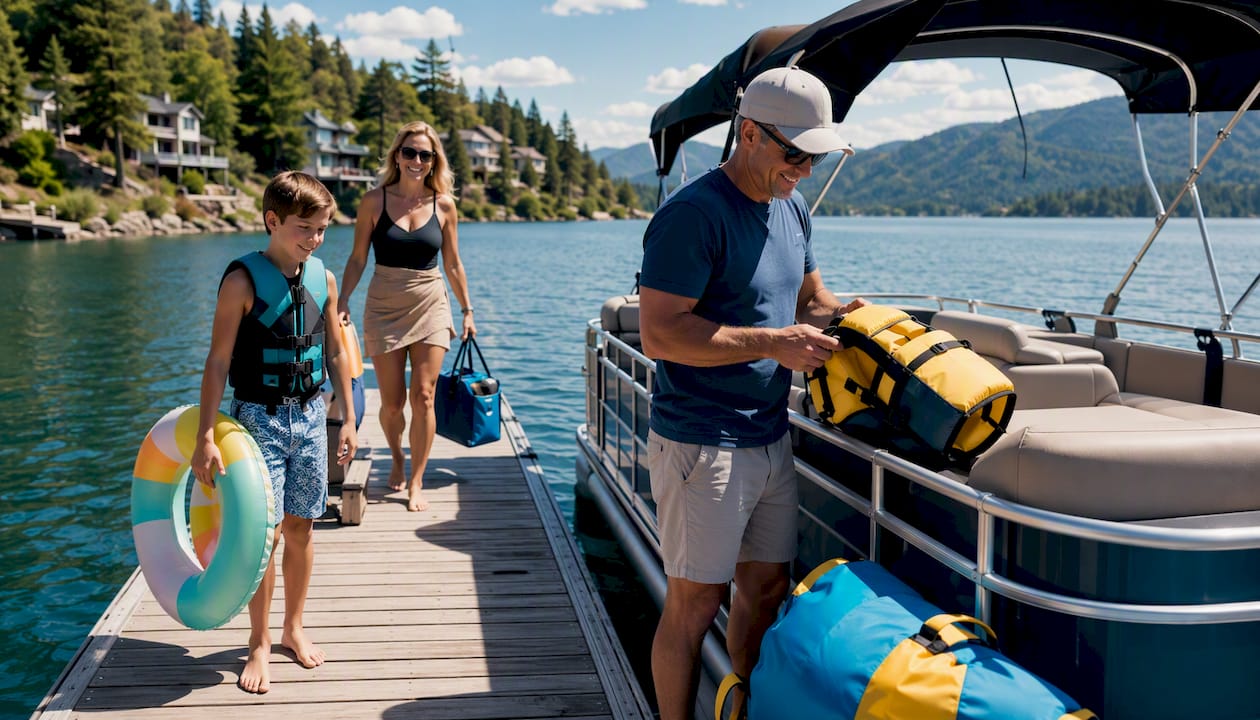
The one thing that surprises most first-time renters: cell coverage on Lake Coeur d'Alene is inconsistent in the northern arms. Download your offline charts before you leave the dock. Every time.
Ready to try these apps on Lake Coeur d'Alene?
Apps are only as good as the water you test them on. Goldenwatersports puts you on Lake Coeur d'Alene in a pontoon, ski boat, or Yamaha WaveRunner with safety equipment included and a pre-departure briefing from staff who actually use these tools on local water. No guesswork about which cove to explore or where the shallows are — the rental includes local knowledge alongside the gear.
Goldenwatersports offers hourly and multi-day rentals with flexible scheduling, so you can plan a half-day outing to test your new app setup or a full weekend on the lake. Check availability and current pricing and book the outing where your new app pairing gets its first real workout.
Sources
- Best navigation apps: 6 top options tested - Yachting World
- Navionics® Boating - Apps on Google Play
- Best Marine Navigation App for iOS in 2025